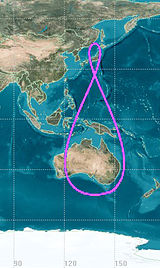
During the course of a day, the geosynchronous satellite's position in the sky forms a 8-like figure. I'm having trouble visualizing the movement of geosynchronous satellite when viewed from the surface of the earth. How does the inclination angle vary with respect to time. Why does the oscillation gets smaller as the inclination angle decrease?
-
$\begingroup$ I meant that are they always visible to us at any time of the day? If not, how and when do they exactly go out of sight. What are their shapes when they are overhead or on the horizon. $\endgroup$– Alec SmartCommented Aug 1, 2016 at 13:28
-
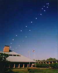
5$\begingroup$ The image in this question has nothing to do with the question. The image is of the analemma. If one takes a photo that includes the Sun at the same time of day (according to a clock) with exactly the same camera angle, and then combines all of those photos into one, the result will be the shown image. $\endgroup$– David HammenCommented Aug 1, 2016 at 13:51
-
$\begingroup$ @DavidHammen I could not find the image(s) depicting oscillatory movement ( I was hoping to find it here.) So I put one that closely resembles their traced path over the course of a day. $\endgroup$– Alec SmartCommented Aug 1, 2016 at 14:36
-
$\begingroup$ This is a look from a highly-inclined GEO satellite - i.imgur.com/sll0Rei.gif (this is KSP, not Earth, but...). You can imagine how this would look from the surface - the main "north-south" movement, with the (comparatively) slight wiggle to east and west. $\endgroup$– LuaanCommented Aug 1, 2016 at 15:48
-
$\begingroup$ @Luaan Yes, I'm able to form a picture in my mind. Got myself a small globe to make it clearer. $\endgroup$– Alec SmartCommented Aug 1, 2016 at 23:04
2 Answers
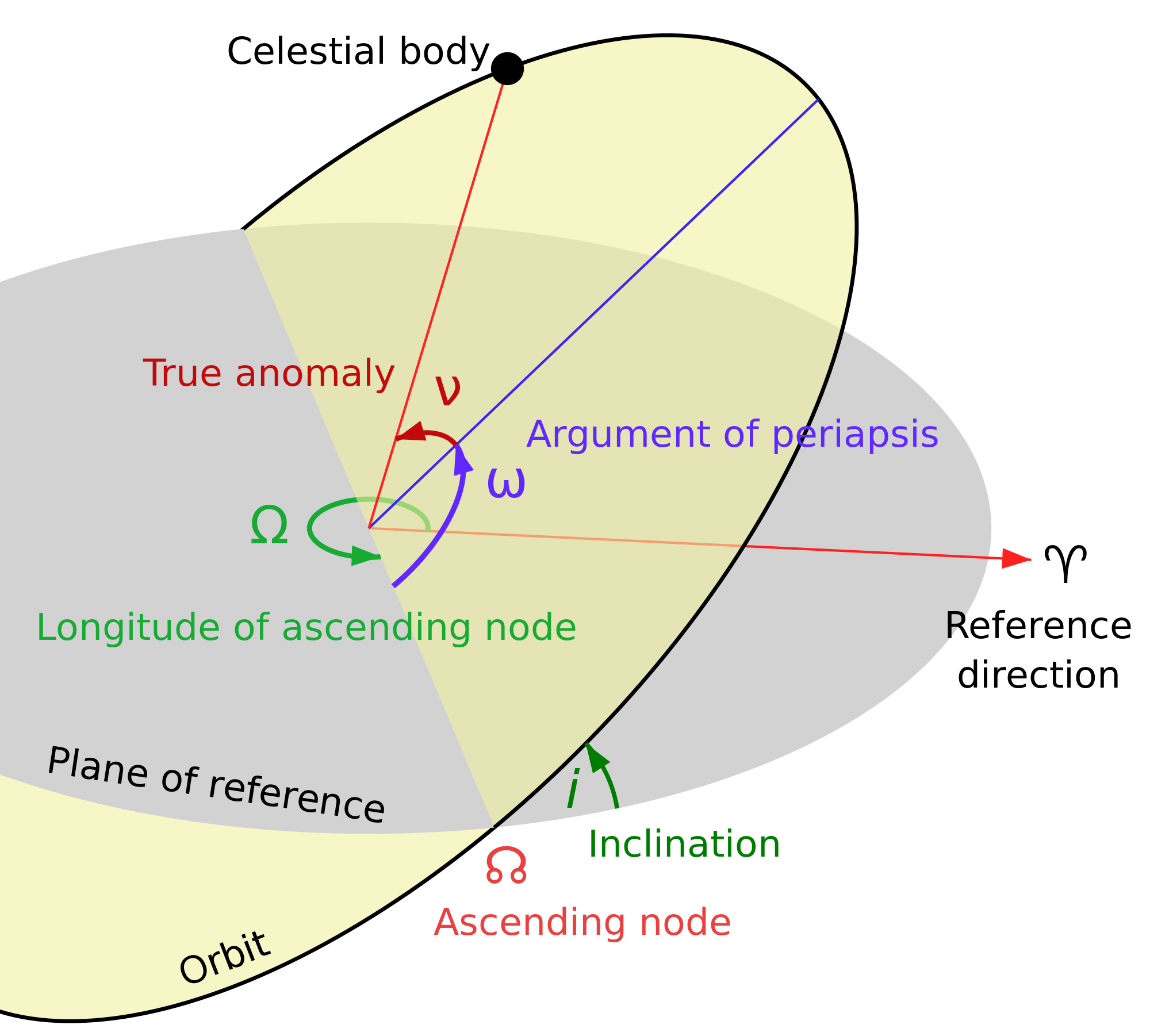
Let's first look at a typical orbit first for comparison. Note that the object being orbited could be anywhere.
Note that it spends a time both above and below the equator. A few things about a Geosynchronous orbit:
- The inclination varies with time, although this isn't that important for day to day operations.
- The period is 24 hours, but a geostationary satellite either isn't perfectly circular, or 0 inclined.
The orbit you have shown is an elliptical inclined geosynchronous orbit. The shape is actually called an Analemma. In fact, the image you provided is of the Sun doing something similar to what these spacecraft will do on a daily basis.
The inclination is responsible for the up and down motion. The sideways part is due to the eccentricity primarily, although an inclined orbit will show a slight variation due to the changing relative velocity compared to the Earth's surface the higher it goes. The spacecraft moves faster when closer to Earth, and thus will be somewhat ahead of the Earth. When it is further, it moves slower, moving back in the other direction.
-
3$\begingroup$ @AlecSmart that would be a good "next question". There could be many answers, so try to specify what you want. Are you looking for just an drawing on-line, or a web site that might do it, or an equation that you could plot yourself. Do you have one particular satellite in mind, or more general? $\endgroup$– uhohCommented Aug 1, 2016 at 14:34
-
1$\begingroup$ @AlecSmart good questions can sometimes come in twos and threes, that's OK. In stackeschange the best way to get answers is to ask them separately. It can be a little difficult at first, but you'll see it can actually help you by reading multiple answers - and working to clarify your questions. They are good questions! If you want to mention how different types of orbits behave - it will really help if you can name a specific satellite, or show the image or data that makes you say one kind moves and one doesn't. Specific examples attract better answers (usually) :) $\endgroup$– uhohCommented Aug 1, 2016 at 15:30
-
1$\begingroup$ "The sideways part is due to the eccentricity" -- this is not entirely true. A perfectly-circular orbit will still exhibit the figure-8 ground track. $\endgroup$– ChrisCommented Aug 1, 2016 at 17:38
-
1$\begingroup$ «A perfectly-circular orbit will still exhibit the figure-8 ground track.» I think it will be a degenerate form of a figure-8, looking like a straight line. My paper plate model (even as a thought experiment) shows that it will drift left as it rises, and the places where the inclined disk crosses the ground disk is symmetrical, so it will retrace the same path in reverse as it lowers back to the equator. Hmm, this models my observer at the equator too; but raising the ground plate so it crosses the arch at higher than its diameter will not break this symmetry. $\endgroup$– JDługoszCommented Aug 2, 2016 at 2:06
-
1$\begingroup$ With zero eccentricity, the speed of the satellite remains constant. Thus if the orbit is inclined, the satellite's angular velocity around the axis of Earth varies (consider the projection of the velocity vector of the satellite on the equatorial plane): it's highest when the latitude of the satellite is at its extreme and lowest when the satellite crosses the equatorial plane. ... $\endgroup$– JiKCommented Aug 2, 2016 at 12:48
I suggest building a 3D model to understand it.
Start with a nice disk, such as a paper plate or the cardboard packaging of a frozen pizza. Mark the center and draw regularly spaced radial lines (“slices”) across the face of the plate. Number the lines at the rim and duplicate the labels farther inward too.
Cut a ring off the plate, about 1 inch wide. If you can, leave a tiny bit uncut at opposide sides so the ring is still attached at 2 points and can pivot at that location.
Tip the ring 60 degrees or so from the plate. The difference in drift is larger if the inclination is high, but lining up and sighting might be easier if not so high.
Cut tiny notches in the ring and remaining plate, and then a fine string can hold the contraption in place so it doesn’t flop around.
Now, for each marked line on the plate, sight where it lines up visually on the tilted ring now. You need a right angle: get a small scrap of wood or carboard box and tape a large cardboard triangle to one face. Now you can line up the bottom of the triangle with a line on the main plate and know it’s standing normal to the plate’s surface.
Now see where the triangle touches the detached ring. Each mark on the flat plate represents your sightline as the Earth turns. The corresponding mark on the arch is where the satellite is at that time. So look at the height to see that the sattelite appears to rise in the sky, and look at how its position will be to the left or right of your sightline: this is the side to side motion you see.
Where the arch meets the flat plate, you can approximate it in 2 dimensions as a horizontal ruler and a diagonal ruler. The same length along the diagonal ruler will not not reach as far horizontally (East) so the rising sattelite falls behind the turning Earth.
At the top of the arch, the highest point in the sky, the sattelite is directly overhead again. The setting part is a mirror image. So, you see it rise and drift left at first, then back to the right until it reaches the highest point, keeps going right as it sets, then back left again to set at the original position. Below the horizon it does the same thing upside down.
If viewing at other than the equator (lift the plate up within the arch model) then the two lobes will be asymmetrical.
See wikipedia for Analemma of Geosynchronous Satellites.
The figure 8 you show (taken from here and explained on that page) is related but different. The position of the sun at the same civil time each day will move because the axis is tilted and the eccentric orbit moves faster when closer to the sun and slower when farthest away, though the Earth turns at a constant rate. So you get arcs that move north-south depending on the time of year and the sun is earlier or later along the arc depending on the time of year.
-
$\begingroup$ I wish I could see a photo! It's a nice description but I'm still having trouble imagining how to actually do this. $\endgroup$– uhohCommented Aug 1, 2016 at 22:59
-
1$\begingroup$ I just read over the instructions. I'll make some notes and then follow them exactly as they are stated. I'll get back to you in case I'm stuck somewhere. Thank you. $\endgroup$ Commented Aug 1, 2016 at 23:34
-
$\begingroup$ «I'm still having trouble imagining how to actually do this» that’s why I suggest a physical prop. Even a drawing won’t convey everything clearly (though the 2D approximation at the crossing point is enlightening). $\endgroup$– JDługoszCommented Aug 2, 2016 at 1:23
-
$\begingroup$ What do the parts in this model model? What is the length referred to in "The length is the same on both pieces..."? $\endgroup$– JiKCommented Aug 2, 2016 at 12:34
-
$\begingroup$ @jik the marks drawn on the plate and the arch are the same since they were drawn before cutting. Now the marks on the arch indicate the sat’s position and on the ground indicate your position on the rotating Earth. $\endgroup$– JDługoszCommented Aug 2, 2016 at 15:46


