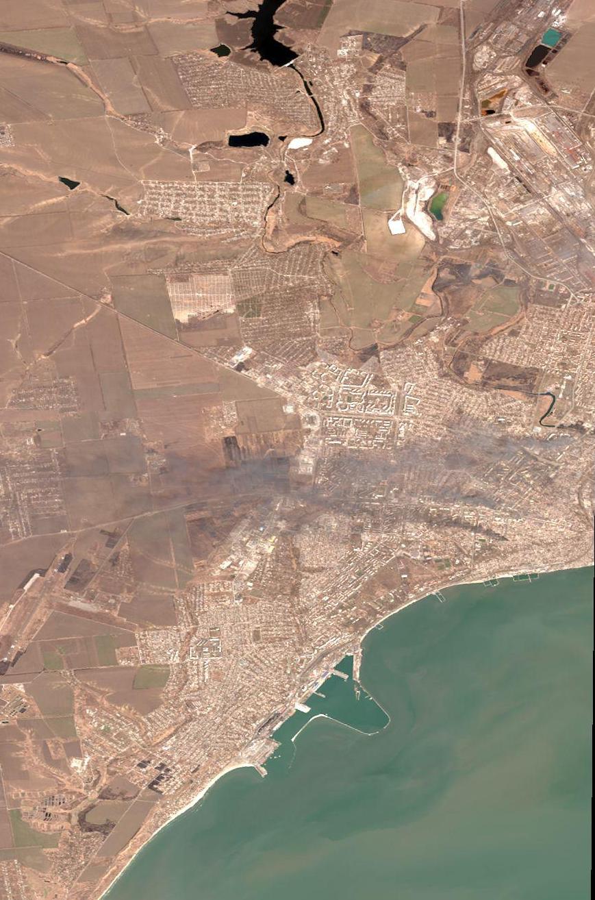
In the news I often see satellite images from Maxar Technologies showing a neighborhood or sector of Mariupol to have been destroyed in shelling. However, I would like a more comprehensive view of the situation as the siege of Mariupol is ongoing. Is there any way to access a database of Maxar's recent images of Mariupol and stitch them together to get a representative view of the total extent of the destruction? Or is there a database of recent satellite images from companies similar to Maxar?
-
2$\begingroup$ @trondhansen I am happy to go asking with the consensus and would support migrating to the space site if it's deemed appropriate. $\endgroup$– TomCommented Mar 21, 2022 at 18:41
-
1$\begingroup$ gannett-cdn.com/presto/2022/03/17/USAT/…, which I accessed as photo #4 in usatoday.com/picture-gallery/news/world/2022/03/17/… (with caption: This color infrared satellite image provided by Maxar Technologies shows fires burning near Fontanna street in eastern Mariupol, Ukraine on Monday, March 14, 2022.), shows the widest view I've seen. Still a small subsection of Mauripol, but perhaps a broader idea at least. $\endgroup$– JeopardyTempestCommented Mar 22, 2022 at 8:27
-
1$\begingroup$ Are you willing to pay for it? A lot of Earth Observation (EO) imagery and data is only available to paying customers. ESA Sentinel data is freely available, but that is radar, not in the visible light spectrum. $\endgroup$– LudoCommented Mar 22, 2022 at 13:39
-
1$\begingroup$ @Ludo I would pay a little bit, ideally under 10 USD equivalent. $\endgroup$– TomCommented Mar 22, 2022 at 22:02
-
2$\begingroup$ @JeopardyTempest photos like that one could be useful to me, although all damage to the sides of buildings is hidden because it's taken from a birds eye view. I would be keen for links to more photos on that kind of scale. Birds eye view is ok but I'm especially keen on satellite photos taken from an oblique angle. $\endgroup$– TomCommented Mar 22, 2022 at 22:10
3 Answers
Not a link to visual imagery but a very useful tool for the current situation:
NASA's Fire Information for Resource Management System shows fires everywhere in the world with ~250-500 meter/6 hour resolution. The link above shows Mariupol.
-
2$\begingroup$ Neat, but beware of industrial areas (e.g. this steel plant in Hamilton Canada) $\endgroup$ Commented Mar 22, 2022 at 14:07
-
2$\begingroup$ @BrendanLuke15 To mitigate that one can filter by date on the advanced tab. For example, if you go back a bit there's no fires in the Mariupol area. $\endgroup$ Commented Mar 22, 2022 at 14:21
-
2$\begingroup$ Looks like it could be a useful tool. I find it confusing that there have been hardly any fires in Kharkiv in the past 27 days, I wonder if the shelling has just been that much less than in Mariupol. Is it possible to discount the possibility that there is a weak correlation between shelling and fires, and that the many fires in Mariupol are accounted for by more vehicle fires (tanks/APCs) due to close-in urban fighting compared to Kharkiv? Would the Fire Information for Resource Management system pick up vehicle fires? $\endgroup$– TomCommented Mar 22, 2022 at 22:28
-
1$\begingroup$ @Tom Mariupol has been without water for quite some time now and the bombardment is so heavy that it's unsafe to go out. This means the fire brigades aren't able to put out the fires. As I understand it, Kharkiv's water supply hasn't been affected and the attacks aren't as heavy so fire services can put any fires out quickly. The fires that are visible are at the points where the Russian advance has stalled. You can see a similar pattern in other areas of the country. In other words, fires == siege or active battlefield. $\endgroup$ Commented Mar 23, 2022 at 3:19
MAXAR subsidiary DigitalGlobe has a web interface tool for viewing very up to date imagery. It is searchable by area, cloud cover, date, sun angle, and off nadir pointing angle (obliquity).
Here is an image of the western half of Mariupol from today (March 23):
Not as high a resolution as the featured release images but tough to get more up to date than this.
Those databases exist, but they're generally not publicly accessible.
There are basically two types of Earth observation data: from agencies (ESA, NASA, JAXA, etc.) and from private companies (Maxar, Satellogic, etc.).
The agencies, being funded with public money, typically make their data freely available, at least to funding countries. However, in my experience, their missions are typically focussed on weather, climate, etc. Their satellites are at high orbits or geostationary and the images are often in spectral bands outside the visible light. Some missions have/had visible light spectral images, but the resolution is not good enough to resolve cities.
Commercial parties have made a business case out of providing high-resolution images in the visible spectrum. Some, such as Satellogic, have swarms of small cubesats in low orbit with high-definition cameras, providing almost streaming data. Of course, companies need to make money and therefore that imagery is provided only to paying customers. Depending on the size, resolution, number of spectral bands, etc. prices can go up to $1000+ per image (from experience, you typically will not find prices on those companies' websites, only "request a quote").
This ESA page provides a nice introduction to what EO data you can expect from which providers. It also provides an (incomplete) list of some of the commercial parties.
In the specific case of Ukraine: Satellogic and Astraea have launched Ukaine Observer, where they provide high-resolution imagery at no cost to qualifying first-aid organisations. Commercial entities with assets in Ukraine may qualify for reduced-cost access. I'm not affiliated with them in any way, so I cannot provide any other details than can be found on the website.
