7
$\begingroup$

Space.com's Space Force plans to send a patrol probe out past the moon includes a quote from the new AFResearchLab video Cislunar Highway Patrol System (CHPS).

"Until now, the United States space mission extended 22,000 miles [35,400 kilometers] above Earth," the video states, referring to the altitude at which geostationary satellites fly. "That was then; this is now."

"The Air Force Research Laboratory is extending that range by 10 times and the operations area of the United States by 1,000 times, taking our reach to the far side of the moon into cislunar space, far beyond the crowd," the video's narrator continued.

Question: Is GEO or just slightly above it the furthest from Earth that any military spacecraft is thought to have been intentionally deployed or moved to or through? If not, what is the furthest from Earth to which this has been done?

Further reading:

  • A Primer on Cislunar Space M. J. Holzinger, C. C. Chow, P. Garretson, Approved for public release: distribution unlimited. AFRL 2021-1271
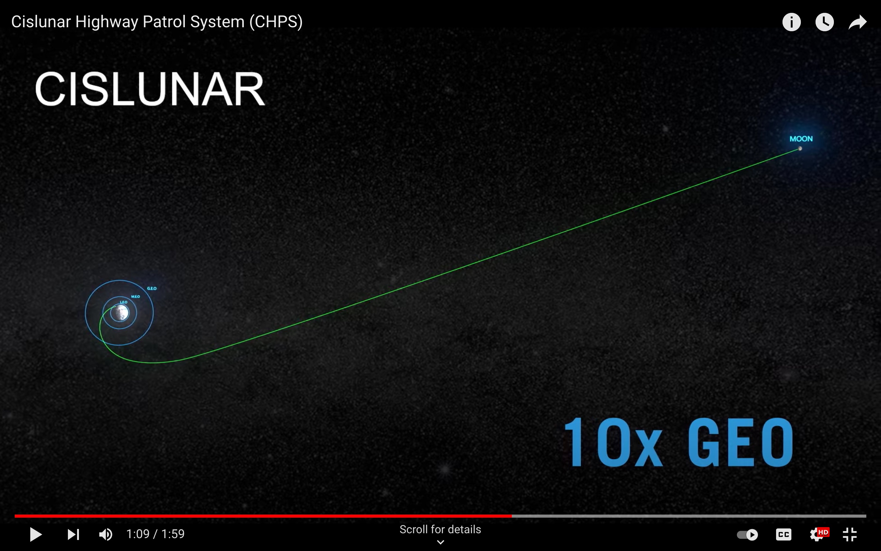
screenshot from the new AFResearchLab video "Cislunar Highway Patrol System (CHPS)" https://youtu.be/yOnPBE1rZNY

$\endgroup$
15
  • 3
    $\begingroup$ I hope it's better than the television series. $\endgroup$
    – Fred
    Commented Mar 6, 2022 at 10:23
  • 12
    $\begingroup$ PR-puffery tag again. $\endgroup$ Commented Mar 6, 2022 at 12:48
  • 6
    $\begingroup$ Another in your long (and interesting) series of questions based on something dumb in a PR release. I understand it can be hard to keep up the question pace sometimes. $\endgroup$ Commented Mar 6, 2022 at 13:04
  • 2
    $\begingroup$ @OrganicMarble If there are actionable recommendations for improving it I'm all ears. But these ambiguous "puffery" comments seem more gratuitous than helpful or actionable. $\endgroup$
    – uhoh
    Commented Mar 7, 2022 at 0:52
  • 2
    $\begingroup$ @OrganicMarble The PR-puffery has made me avoid answering many of this user's questions. $\endgroup$ Commented Mar 7, 2022 at 11:19

2 Answers 2

17
$\begingroup$

There are other satellites that were launched that went beyond GEO:

SOLRAD 11A and SOLRAD 11B by the US Naval Research Laboratory:

SOLRAD 11A was one of a pair of identical satellites that were placed in a circular equatorial orbit of 20 earth radii.

Funding Agency : Department of Defense-Department of the Navy (United States)

Also Clementine was built and operated by the Naval Research Laboratory:

Clementine (officially called the Deep Space Program Science Experiment (DSPSE)) was a joint space project between the Ballistic Missile Defense Organization (previously the Strategic Defense Initiative Organization) and NASA, launched on January 25, 1994. Its objective was to test sensors and spacecraft components in long-term exposure to space and to make scientific observations of both the Moon and the near-Earth asteroid 1620 Geographos.

$\endgroup$
2
  • 3
    $\begingroup$ I think you accidentally a link for Clementine there, so I edited one in for you. For those who don't naturally think in Earth-radii, like me, 20 of them is ~127562.0 km, comfortably further out than Vela. $\endgroup$ Commented Mar 6, 2022 at 14:08
  • $\begingroup$ Is a solar research satellite a military spacecraft if it is launched by the US Naval Research Laboratory instead of the NASA? $\endgroup$
    – Uwe
    Commented Mar 14, 2022 at 19:35
14
$\begingroup$

It is fairly trivial to disprove the "not above GEO" line, at least... Vela 1A was operated by the USAF and has a circular orbit in HEO at ~100000km perigee, for example. Things in Molniya orbits (such as Kosmos 2105 might reasonably have an apogee above GEO too, though not as far out as Vela and I'm not sure if the US military operated things in those sorts of orbit.

I haven't found any mention of any other military satellites further out that that. As far as I can tell, most modern military programs operate larger numbers of satellites in lower orbits (like the DSP and SBIRS programs that are the modern counterparts of Vela). There are some papers talking about the potential usefulness of military communications satellites in Lagrange points, but I don't see any obvious evidence that anyone has bothered doing that so far.

$\endgroup$
3
  • $\begingroup$ Nice answer, was coming here to mention Vela. $\endgroup$ Commented Mar 6, 2022 at 12:47
  • 1
    $\begingroup$ I suspect you meant apogee rather than perigee with regard to Molniya orbits. Their perigees can be rather low. Satellites in Tundra orbits also go higher than GEO altitude. $\endgroup$ Commented Mar 7, 2022 at 11:05
  • $\begingroup$ @DavidHammen oops, you are quite right. Fixed. $\endgroup$ Commented Mar 9, 2022 at 9:29

Your Answer

By clicking “Post Your Answer”, you agree to our terms of service and acknowledge you have read our privacy policy.

Not the answer you're looking for? Browse other questions tagged or ask your own question.