The BBC article SpaceX aims to launch internet from space discusses the SpaceX proposal for a dense array of over 4,000 LEO satellites for global internet coverage, and links to SpaceX non-Geostationary Satellite System Attachment A - Technical Information to Supplement Schedule S.
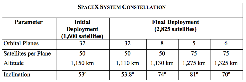
The initial configuration will be the first group of 1,600 active satellites (plus spares) at 32 orbital planes of 50 satellites each, all at an inclination of 53 degrees and a LEO altitude of 1,150 km. The final configuration adds to that four more sets of planes at four more inclinations and altitudes, for a grand total of 4,425 active satellites (plus spares).
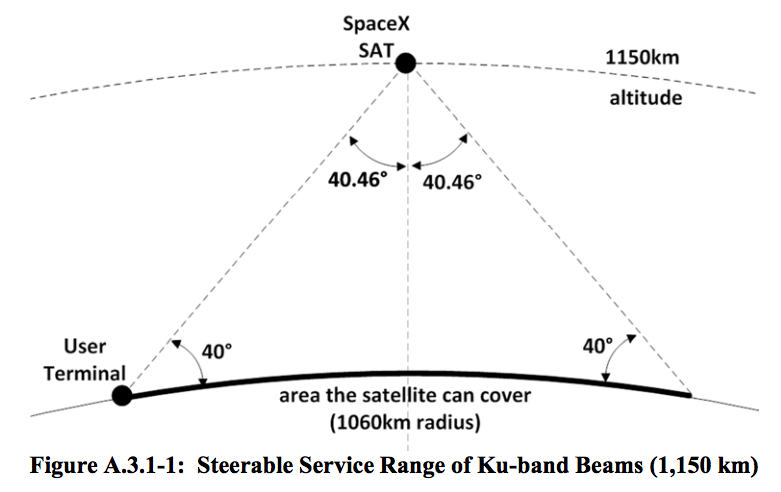
If I understand correctly, this configuration is supposed to provide global coverage such that any place on earth will see at least one satellite above 40 degrees elevation at all times.
My question is - how does this constellation's configuration actually work? Do these inclinations and altitudes satisfy some expected behavior for nodal precession? Is there some ellegant orchestration here? There are five slightly different altitudes, which means each group will have a slightly different period, so I don't think the different groups are phased relative to each other, only within a group or at least within each plane of each group.
Are there five different altitudes simply for collision avoidance - which is more difficult between planes of mixed inclinations than between planes of identical inclination (but different nodes)?
Q: How does this constellation's configuration actually work? - what is the method behind the madness? (idomatically speaking)
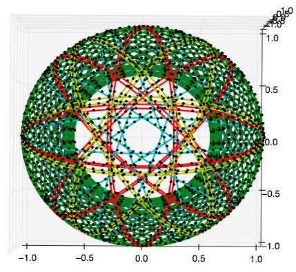
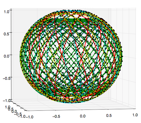
Here are some simple plots. I'm working on better ones - hopefully an animation or a 2D map with groundtracks.
above x2: screen captures from SpaceX non-Geostationary Satellite System Attachment A - Technical Information to Supplement Schedule S.


