How do I calculate the maximum northern and southern latitude a LEO satellite can image? What parameters would I need?
$\begingroup$
$\endgroup$
4
-
2$\begingroup$ Angle of view for the camera. Orbit altitudes. Orbit Inclination. Trigonometry. $\endgroup$– A McKelvyCommented Jun 9, 2023 at 12:45
-
1$\begingroup$ See if space.stackexchange.com/q/60109/37597 helps you. $\endgroup$– Ryan CCommented Jun 9, 2023 at 15:26
-
2$\begingroup$ You'll also need orbital eccentricity, and if the orbit's not circular, you'll need argument of periapsis. $\endgroup$– notovnyCommented Jun 9, 2023 at 17:25
-
$\begingroup$ Here are some equations dealing with the furthest visible point for a given altitude: celestialprogramming.com/horizondistance.html $\endgroup$– Greg MillerCommented Jun 10, 2023 at 4:18
Add a comment
|
1 Answer
$\begingroup$
$\endgroup$
0
For the most simple case:
- Circular inclined orbit
- Camera looking in all directions
- Spherical Earth
- Ignoring the atmosphere
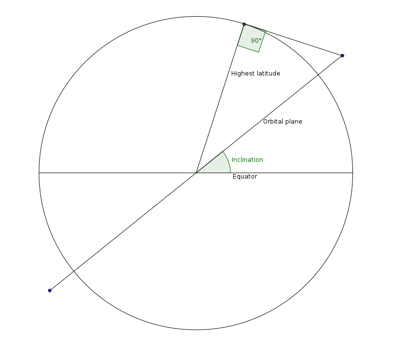
Then you the highest latitude you can image is the sum of the inclination and an angle in a right triangle.
$$\phi = i + \cos^{-1}\left(\frac{r}{r + h}\right)$$
Where $h$ is the altitude of the satellite.
The flat view at the extreme latitude isn't very good.
